[donotprint]
If you do not own the book please buy a copy here![/donotprint]
[print_link]
Ride Information
START/FINISH: Car Park, Simonsbath TA24 7SH, 51.140150, -3.753494
DISTANCE: 46.6 miles/75.0km
ASCENT: 6945ft/2117m
OFF-ROAD: 85%
TERRAIN: Peaty moorland, stony singletrack and river paths. Plenty of climbs and occasional river crossings.
NAVIGATION: Difficult. The bridleways across the moorland, particularly on the northern half of the ride, can be faint
or almost non-existent at times. Although the Two Moors Way is signposted on the way south from Cheriton it is easy
to drop down into Farley Water by mistake, so make sure you keep right at Roborough Castle. Stay right further along
Cheriton Ridge too, to avoid crossing Clannon Ball (steep and very rocky) and meeting the road too soon. OS
Landranger 180 would be useful.[donotprint]
Maps
Ordnance Survey Map
[osmap height=”400″ width=”auto” color=”red” gpx=”https://www.wildthingspublishing.com/wp-content/uploads/bikepacking/Bikepacking Ride No.6_Exmoor.gpx”]
Open Street Map with information markers and elevation
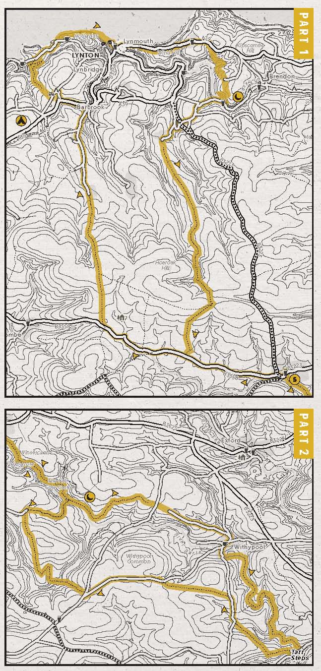
Book Map[/donotprint]
 [donotprint]Downloadables
Download .GPX file (right click to download)
Download map.pdf from the book (right click to download)
How to navigate using .GPX files[/donotprint]
Eat & Drink
The Rockford Inn, Bredon, North Devon EX35 6PT, 01598 741214, www.therockfordinn.co.uk
The Village Inn, 19 Lynmouth Street, Lynton, Devon EX35 6EH, 01598 752354, www.thevillageinnexmoor.co.uk
Sleep
Exmoor Forest Inn, Simonsbath, Minehead, TA24 7SH, 01643 831341, www.exmoorforestinn.co.uk
Camp: Caffyns Farm, Croscombe Lane, Lynton EX35 6JW, 01598 753967, www.exmoorcoastholidays.co.uk
Bivvy: woods by Cow Castle, River Barle
Provisions
Boeveys Tea Rooms, Simonsbath, Minehead TA24 7SH, 01643 831622
Exmoor Bike, Unit 1 Enterprise Centre, Enterprise Park, Minehead, Somerset TA24 5AE, 07920 047901, www.exmoorbike.com
 [donotprint]Downloadables