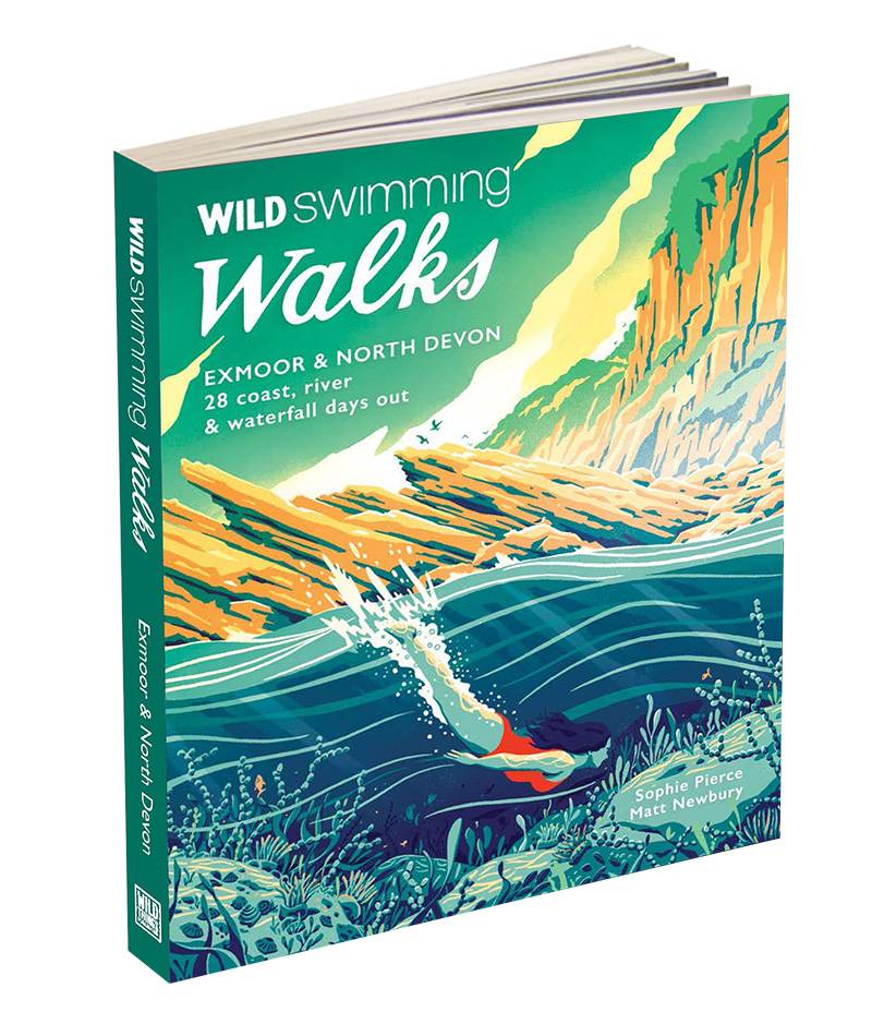
Wild Swimming Walks Exmoor & North Devon
£14.99
Exmoor & North Devon – 28 river, lake & coastal days out
by Sophie Pierce & Matt Newbury
Also available as ebook and kindle here
International customers will find it easier to buy on Amazon or Book Depository (free international shipping).
190 x 150mm with flaps. 204pp, 29 maps
Description
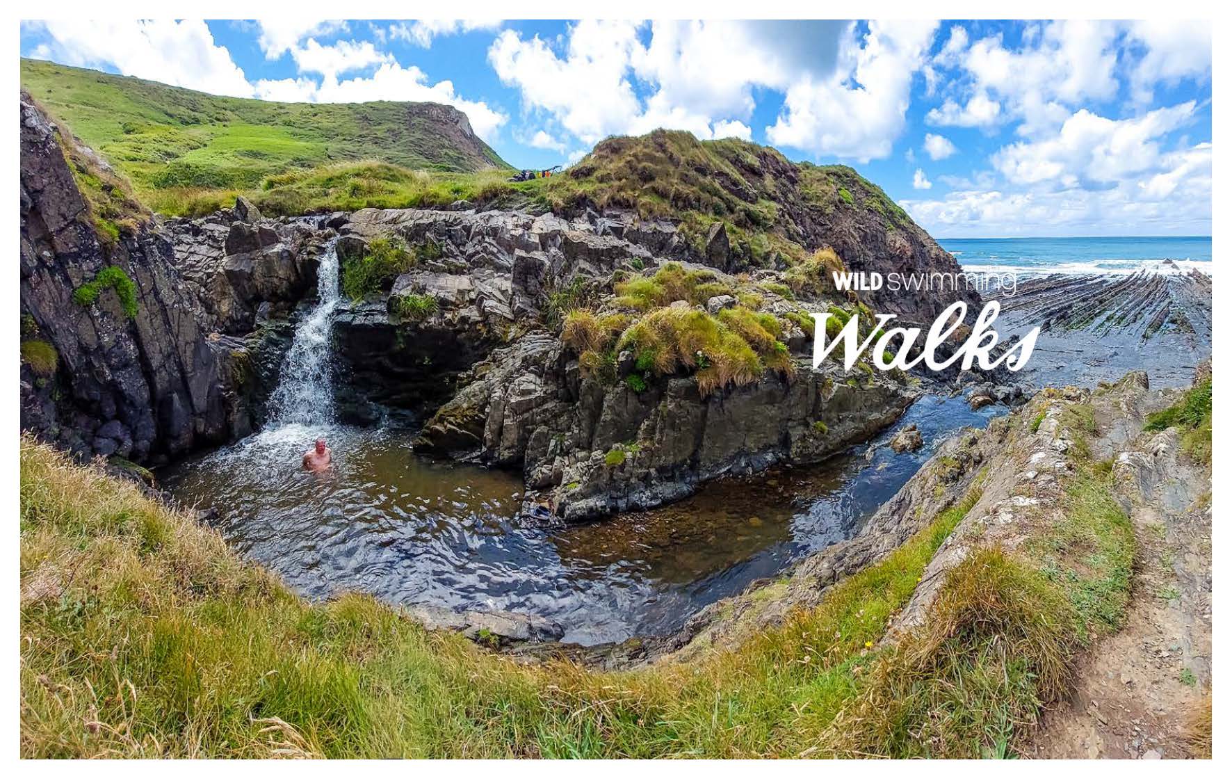
Wild Swimming Walks leads you on 28 adventures through the soaring landscape of Exmoor and North Devon. Find secret coves, remote river pools and sparking waterfalls.
Complete with photos, maps and practical guidance, and rich in local history and stories, this book will appeal to wild swimmers, family explorers, nature lovers and walkers alike.
JOIN THE ADVENTURE with the best-selling Wild Swimming Walks series and explore North Devon and Exmoor’s spectacular scenery, with its towering cliffs, turquoise seas, remote moors and hidden pools.
- Explore intriguing islands and estuaries
- Walk through woodland gorges carved by cascades, dipping on the way
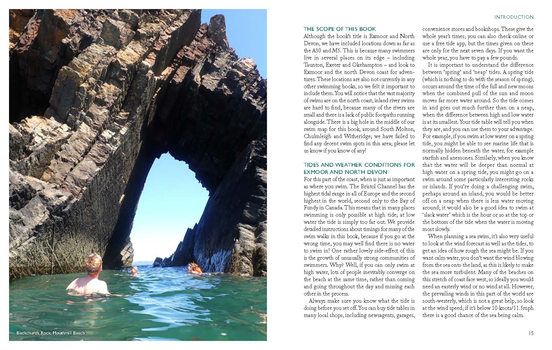
- Swim under the dramatic sea arch of Blackchurch Rock
- Plunge into crystal-clear river pools
- Cool off under Devon’s famous hanging waterfalls
- Marvel at Exmoor’s monumental hogsback cliffs
Including detailed directions, maps and downloadable route information to print out or take with you on your phone or tablet.
Sophie Pierce and Matt Newbury live in Devon and are passionate swimmers, explorers and travel writers. They are co-authors of several Wild Swimming Walks books (Cornwall, Dartmoor, Dorset and Torbay). Sophie is a writer and broadcaster who is never happier than when in the water, and is the author of a memoir about grief, swimming and walking, The Green Hill.
Matt is an author, event manager and the Creative Director of the Agatha Christie Festival. He loves taking part in fun swimming challenges around the world.
Introduction
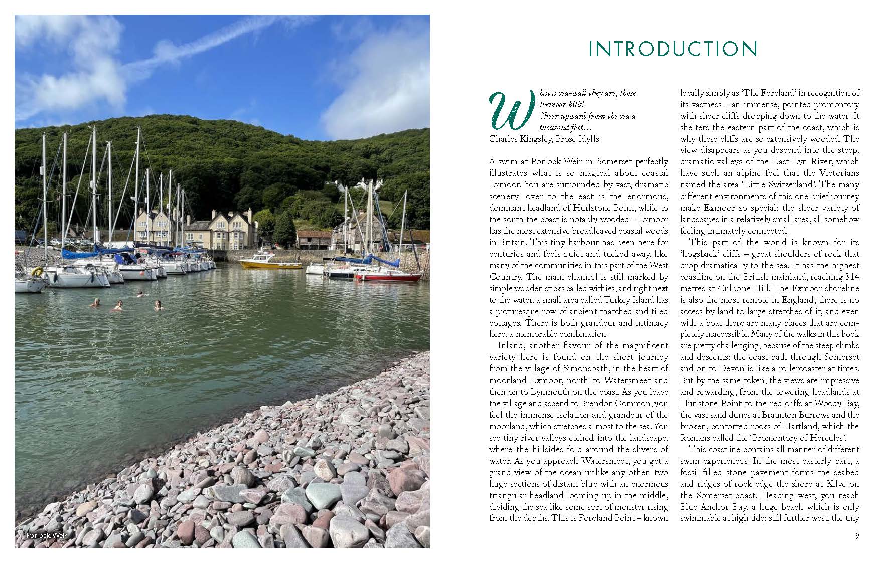
A swim at Porlock Weir in Somerset perfectly illustrates what is so magical about coastal Exmoor. You are surrounded by vast, dramatic scenery: over to the east is the enormous, dominant headland of Hurlstone Point, while to the south the coast is notably wooded – Exmoor has the most extensive broadleaved coastal woods in Britain. This tiny harbour has been here for centuries and feels quiet and tucked away, like many of the communities in this part of the West Country. The main channel is still marked by simple wooden sticks called withies, and right next to the water, a small area called Turkey Island has a picturesque row of ancient thatched and tiled cottages. There is both grandeur and intimacy here, a memorable combination.
Inland, another flavour of the magnificent variety here is found on the short journey from the village of Simonsbath, in the heart of moorland Exmoor, north to Watersmeet and then on to Lynmouth on the coast. As you leave the village and ascend to Brendon Common, you feel the immense isolation and grandeur of the moorland, which stretches almost to the sea. You see tiny river valleys etched into the landscape, where the hillsides fold around the slivers of water. As you approach Watersmeet, you get a grand view of the ocean unlike any other: two huge sections of distant blue with an enormous triangular headland looming up in the middle, dividing the sea like some sort of monster rising from the depths. This is Foreland Point – known locally simply as ‘The Foreland’ in recognition of its vastness – an immense, pointed promontory with sheer cliffs dropping down to the water. It shelters the eastern part of the coast, which is why these cliffs are so extensively wooded. The view disappears as you descend into the steep, dramatic valleys of the East Lyn River, which have such an alpine feel that the Victorians named the area ‘Little Switzerland’. The many different environments of this one brief journey make Exmoor so special; the sheer variety of landscapes in a relatively small area, all somehow feeling intimately connected.
This part of the world is known for its ‘hogsback’ cliffs – great shoulders of rock that drop dramatically to the sea. It has the highest coastline on the British mainland, reaching 314 metres at Culbone Hill. The Exmoor shoreline is also the most remote in England; there is no access by land to large stretches of it, and even with a boat there are many places that are completely inaccessible. Many of the walks in this book are pretty challenging, because of the steep climbs and descents: the coast path through Somerset and on to Devon is like a rollercoaster at times. But by the same token, the views are impressive and rewarding, from the towering headlands at Hurlstone Point to the red cliffs at Woody Bay, the vast sand dunes at Braunton Burrows and the broken, contorted rocks of Hartland, which the Romans called the ‘Promontory of Hercules’.
This coastline contains all manner of different swim experiences. In the most easterly part, a fossil-filled stone pavement forms the seabed and ridges of rock edge the shore at Kilve on the Somerset coast. Heading west, you reach Blue Anchor Bay, a huge beach which is only swimmable at high tide; still further west, the tiny harbour and shingle of Porlock Weir is a complete contrast. Heading into Devon, at Watermouth you can swim around Sexton’s Burrow, a half-tidal island sitting at the mouth of the cove. Hele Bay, just next to Ilfracombe, has a handy slipway into the water and is sheltered, making it beloved by a big local community of swimmers. Heading down to Baggy Point, you will find an enchanting lagoon on the southern edge of the headland, while Velator Quay at the mouth of the Taw-Torridge estuary is a beautiful tidal river swim off an elegant wooden jetty. The most south-westerly part of the coast in the book, from Bideford to Marsland Mouth, has fantastical rock formations and several huge waterfalls crashing down onto the beaches below. These coastal waterfalls are a feature of this part of the British coast, but rare elsewhere; the only other place they are found in Europe is in the fjords of Norway.
Exmoor is quieter and less showy than its famous neighbour, Dartmoor. It is lower – its highest point is Dunkery Beacon, at 519 metres – and smaller, at 267 square miles. It has a more intimate feel – although it retains a rugged bleakness on the wilder, more exposed expanses. There are several areas of ancient woodland, as well as many charming villages and towns in a predominantly agricultural landscape away from the moor. Its rivers are mostly quite small; the largest is the Barle which rises high on the central moorlands and joins the River Exe at Exebridge. From here the Exe gets progressively bigger as it makes its way to the sea at Exmouth. The book contains swims in both the Barle and the Exe, as well as in smaller watercourses including the East Lyn River and Horner Water. Further south-west, into the districts of North and Mid-Devon and Torridge, lie the great tidal rivers the Taw and the Torridge, but many of the other rivers are quite small and not so good for swimming.
The Victorians loved Exmoor and were responsible for creating many of the features we see today. Tourists were coming as early as the 1820s; in 1823 work started on creating Tunnels Beaches in Ilfracombe, with hundreds of Welsh miners employed to hack tunnels through the cliffs so that people could get to the beaches. Some of their pick-axe marks are still visible on the walls of the tunnels today. Then, three tidal pools were built – two for the ladies and one for the gentlemen; one of them has survived to this day and is well worth a visit.
Tourism took off in earnest when the North Devon Railway Company started operating to Barnstaple and then Bideford in the 1850s; the line was extended to Ilfracombe in the 1870s. Landowners and entrepreneurs saw the potential of the dramatic scenery and set about finding ways of getting the public there. In 1890 the Lynton and Lynmouth Cliff Railway opened, and in 1893 enterprising businessman Benjamin Lake built a road down to Woody Bay, where he also created a tidal swimming pool and a small quay. If not for him, there is no way we would be able to reach this beautiful beach today.
The RD Blackmore novel Lorna Doone, which was published in 1869, has also been bringing tourists to the area for over 150 years. Subtitled A Romance of Exmoor, it is a love story packed with equal parts melodrama and vivid descriptions of the countryside in and around the valley of Badgworthy Water (the Valley of the Doones). Although the novel is probably not to most modern readers’ tastes, the Lorna Doone story is still heavily promoted by local tourism organisations.
Others inspired by the landscape of Exmoor and North Devon include Henry Williamson, author of Tarka the Otter and himself a keen open-water swimmer. Charles Kingsley’s book Westward Ho! was so popular that it led to the creation of a seaside resort named after it, where Rudyard Kipling went to school. The allure and wildness of the scenery also inspired poets including Wordsworth, Coleridge and Shelley.
Today, people enjoy the coast and countryside of Exmoor and North Devon for the same reasons they always have – for their beauty, drama, and peace. There is a growing awareness of the fragility of our wild environments, and a large part of North Devon is designated an UNESCO biosphere, one of only seven in the UK. The area includes all of the coast, Lundy Island and the sea around it, and a huge area inland extending from Okehampton in the south to near Tiverton in the east, taking in a whole variety of places including Hatherleigh, South Molton, and Torrington.
It has been designated for its outstanding natural features. At the shore these include dramatic coastal landscapes, one of the best dune systems in the northern hemisphere, and flagship marine species from dolphins and seals to pink sea fans. Inland, the designation recognises iconic river fauna such as otters and salmon, the blanket bogs of Exmoor, western oak woodlands supporting a multitude of pollution-sensitive lichens, and landscape characteristics such as culm grasslands and Devon hedgerows.
The purpose of UNESCO biospheres is to be ‘learning places for sustainable development’, finding ways to reconcile the conservation of biodiversity with its sustainable use. In North Devon, the biosphere acts as a test-bed for sustainable development in an area of world-class natural value: many projects are in progress, including the control of invasive species such as Himalayan balsam and Japanese knotweed, the management of fisheries to ensure sustainable catches, a programme to use the natural environment to improve public health, and a scheme to develop local supply chains for the green economy.
Contents
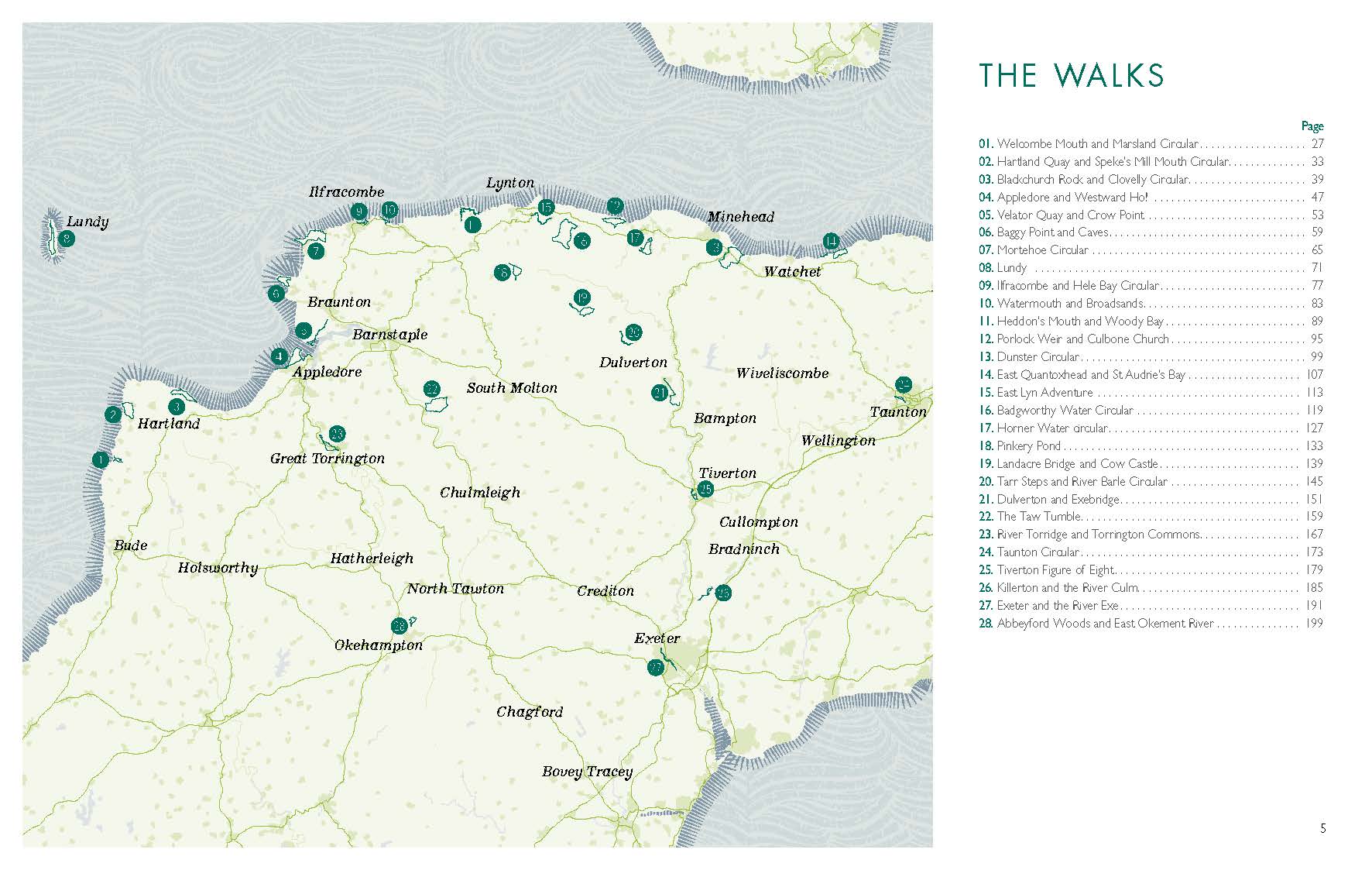
Welcombe Mouth and Marsland Circular
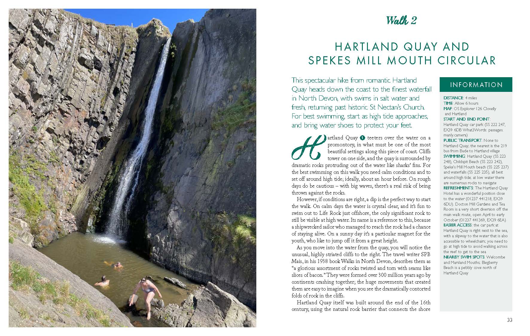
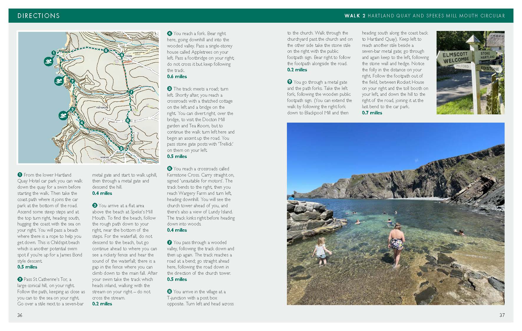
Hartland Quay and Speke’s Mill Mouth Circular
Blackchurch Rock and Clovelly Circular
Appledore and Westward Ho!
Velator Quay and Crow Point
Baggy Point and Caves
Mortehoe Circular
Lundy
Ilfracombe and Hele Bay Circular
Watermouth and Broadsands
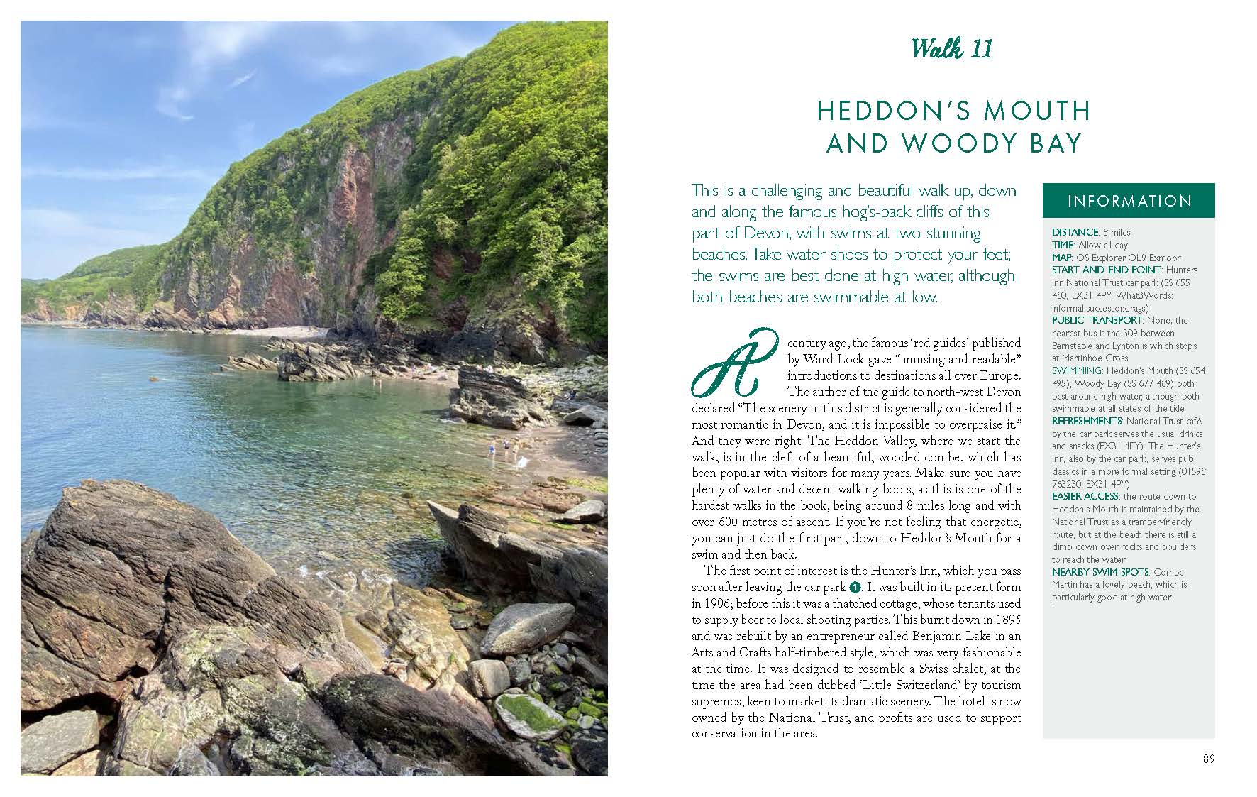
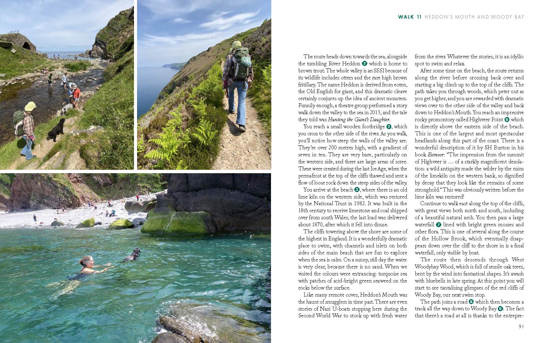
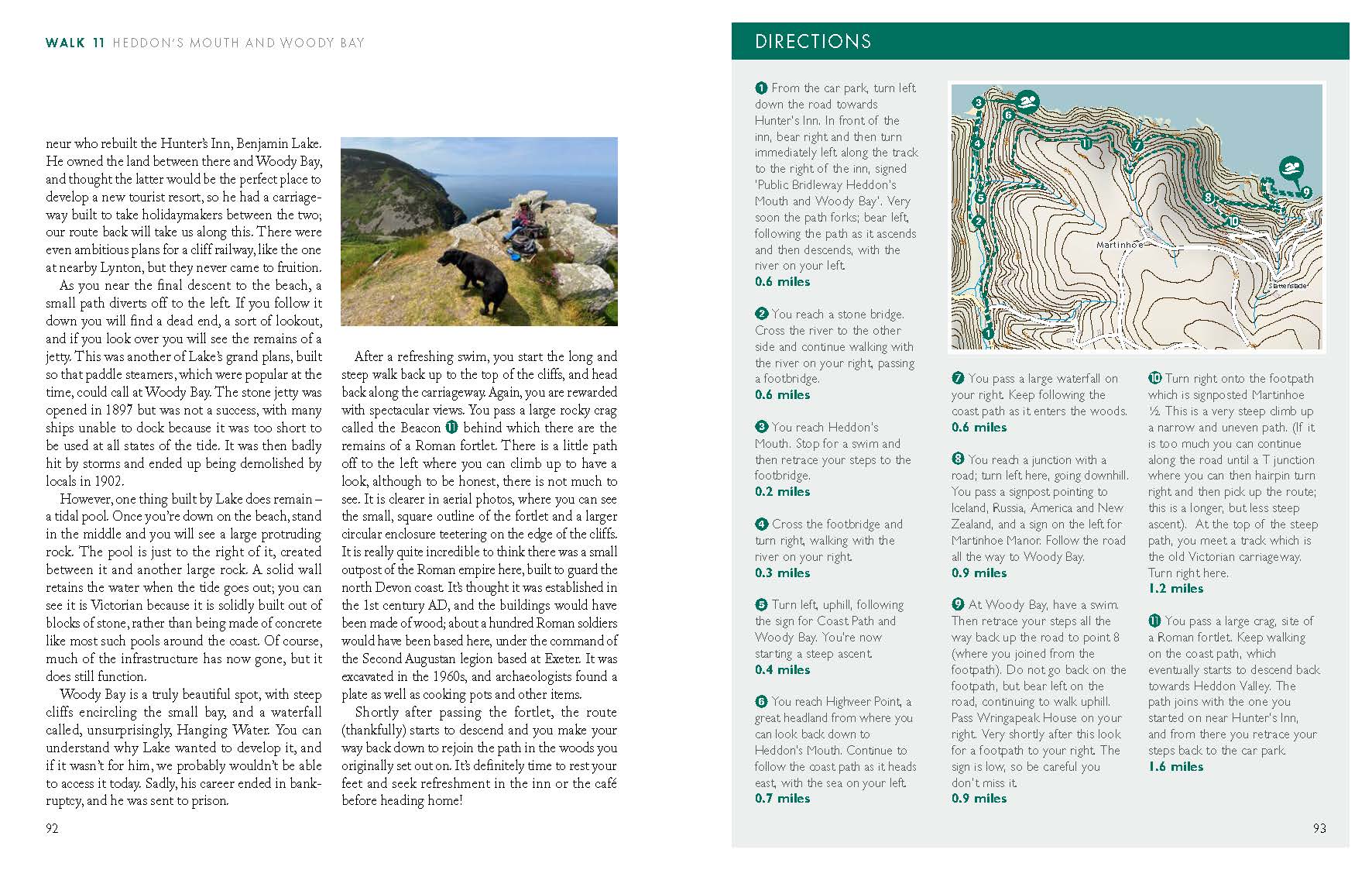
Heddon’s Mouth and Woody Bay
Porlock Weir and Culbone Church
Dunster Circular
East Quantoxhead and St Audrie’s Bay
East Lyn Adventure
Badgworthy Water Circular
Horner Water Circular
Pinkery Pond
Landacre and Cow Castle
Tarr Steps and River Barle Circular
Dulverton and Exebridge
The Taw Tumble
River Torridge and Torrington Commons
Taunton Circular
Tiverton Figure of Eight
Killerton and the River Culm
Exeter and the River Exe
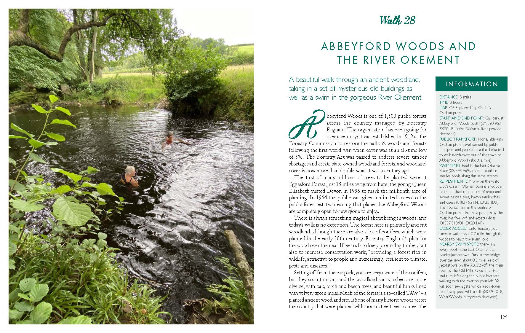
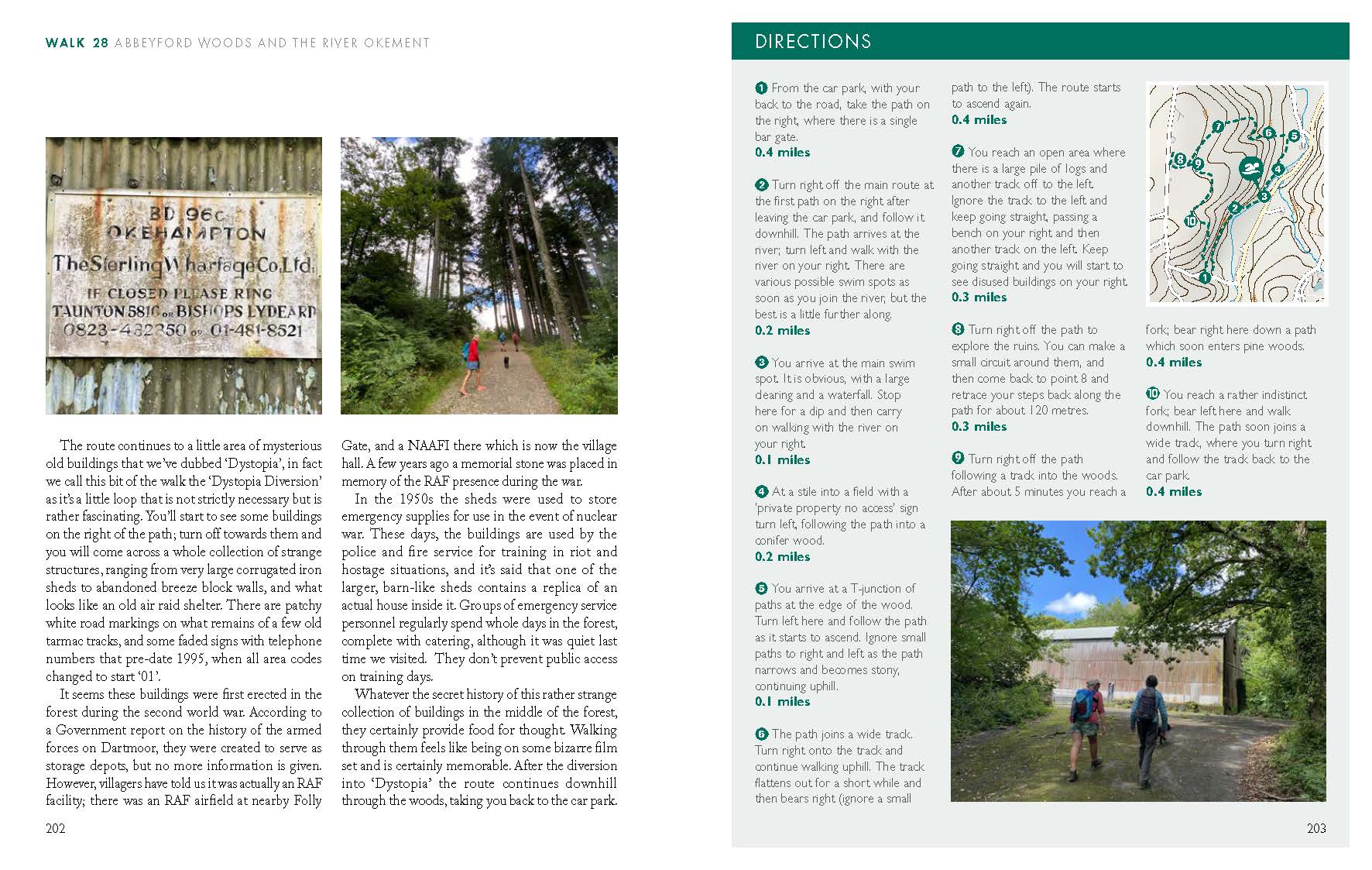
Abbeyford Woods and East Okement River
You might also like...
-

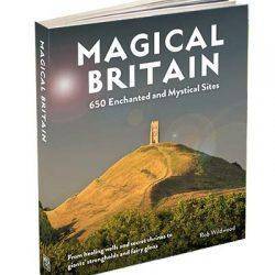
Magical Britain – 650 Enchanted and Mystical Sites
£18.99 Add to cart -
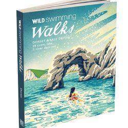
Wild Swimming Walks – Dorset & East Devon
£14.99 Add to cart -
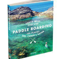
Paddle Boarding South West – 100 places to SUP, Canoe or Kayak
£18.99 Add to cart -
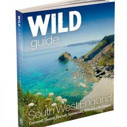
Wild Guide South West – Devon, Cornwall, Dorset, Somerset, Wiltshire and Gloucester
£18.99 Add to cart -
Rock Idols Dartmoor
£14.99 Add to cart -
Wild Swimming Walks Bristol & Bath
£14.99 Add to cart -
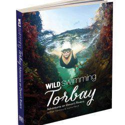
Wild Swimming Torbay Devon
£14.99 Add to cart -
Wild Guide Cornwall
£14.99 Add to cart -
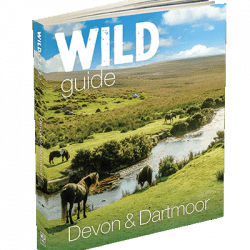
Wild Guide Devon & Dartmoor
£14.99 Add to cart