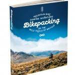
 These pages are for readers of Bikepacking: mountain bike camping adventures on the wild trails of Britain by Laurence McJannet.
If you do not own the book please buy a copy here!
Ride Information
START/FINISH: Hawkshead car park, LA22 0NB, 54.373830, -2.996045
DISTANCE: 13.8 miles/22.2km ASCENT: 2283ft/696m OFF-ROAD: 85%
TERRAIN: Rolling forest trails, paved doubletrack and muddy lake-side trails. There are two fast descents but after leaving Hawkshead most of the climbing is done gradually.
NAVIGATION: Straightforward. The trail is waymarked on the edge of Grizedale forest, and the bridle paths are well signposted. Stay close to the shore all the way along Windermere up to Wray Castle. In the woods at Long Height five paths intersect; make sure you take the furthest right and continue straight ahead down into Colthouse. OS Landrangers 90 and 97 are useful for exploring the area.
Maps
Ordnance Survey Map
[osmap height=”400″ width=”auto” color=”red” gpx=”https://www.wildthingspublishing.com/wp-content/uploads/bikepacking/Bikepacking Ride No.23_Windermere Lake District.gpx”]
Open Street Map with information markers and elevation
Book Map

Downloadables
Download .GPX file (right click to download)
Download map.pdf from the book (right click to download)
How to navigate using .GPX files
Eat & Drink
Tower Bank Arms, Near Sawrey, Ambleside, Cumbria LA22 0LF, 015394 36334, www.towerbankarms.co.uk
Cuckoo Brow Inn, Far Sawrey, Ambleside, Cumbria LA22 0LQ, 015394 43425, www.cuckoobrow.co.uk
Sleep
Low Wray campsite, Low Wray, Ambleside, Cumbria LA22 0JA, 015394 63862, www.nationaltrust.org.uk
Bivvy: Belt Ash Coppice
Provisions
Sun Cottage Tea Rooms, Main Street, Hawkshead, Ambleside, Cumbria LA22 0NT, 015394 36123
Velo Bikes, Grizedale Visitor Centre, Hawkshead, Ambleside, Cumbria LA22 0QJ, 01229 860369

