[donotprint] These pages are for readers of Bikepacking: mountain bike camping adventures on the wild trails of Britain by Laurence McJannet.
If you do not own the book please buy a copy here![/donotprint]
[print_link]
Ride Information
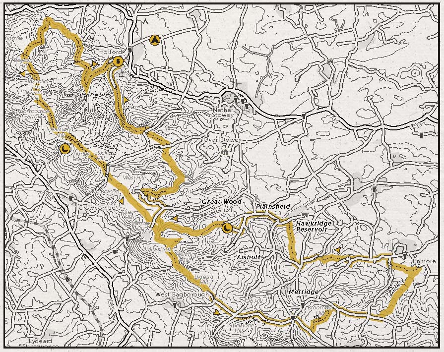
START / FINISH: Car park at Holford TA5 1SA, 51.162554, -3.211318
DISTANCE: 27.4 miles/44.1km
ASCENT: 4133ft/1260m
OFF-ROAD: 80%
TERRAIN: Stony wooded gullies, wide grassy bridleways along the ridge and dirt singletrack through Great Wood. Climbing up the combes tends to be short and sharp; the ridge isn’t flat but the climbs are more drawn out.
NAVIGATION: Straightforward. Despite the multitude of bridleways packed into the Quantocks there are very few that aren’t signposted, and the hills’ compact nature means getting your bearings is never too difficult. OS Landranger 181 can be useful though.[donotprint]
Maps
Ordnance Survey Map
[osmap height=”400″ width=”auto” color=”red” gpx=”https://www.wildthingspublishing.com/wp-content/uploads/bikepacking/Bikepacking Ride No.3_Quantocks.gpx”]
Open Street Map with information markers and elevation
Book Map[/donotprint]
 [donotprint]Downloadables
 [donotprint]Downloadables
Download .GPX file (right click to download)
Download map.pdf from the book (right click to download)
How to navigate using .GPX files[/donotprint]
Eat & Drink
The Bicknoller Inn, 32 Church Lane, Bicknoller, Somerset TA4 4EL, 01984 656234, www.bicknollerinn.com
The Plough Inn, Holford, Somerset TA5 1RY, 01278 741652
Sleep
The Hood Arms, Kilve, Somerset TA5 1EA, 01278 741210, www.thehoodarms.com
Moorhouse Campsite, Holford, Bridgwater, Somerset TA5 1SP, 01278 741295, www.moorhousecampsite.co.uk
Bivvy: Round Hill in Great Wood nr Plainsfield
Provisions
Cricketer Farm Shop & Cafe, Stowey Court Farm, Nether Stowey, Somerset TA5 1LL, 01278 732207, www.cricketershop.co.uk
St John Street Cycles, 91-93 St John Street, Bridgwater, Somerset TA6 5HX, 01278 441500, www.sjscycles.co.uk